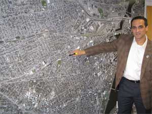
 In a recent visit to the Somerville Chamber of Commerce, Mayor Joseph Curtatone used a custom mounted 8’ x 12’ satellite image of greater Somerville to enhance the planning process for upcoming economic development and transportation initiatives. The image includes Somerville, Cambridge, and downtown Boston.
“This kind of imaging tool gives us a perspective and a level of detail that truly enhances the planning process,” said Curtatone. “You can see and appreciate Somerville’s position in the urban core, but you can also drill down to precise details on every parcel.” Developed and marketed by Mendon-based Visual Magnetics, the surface of the wall-sized planning tool is both magnetized and erasable for easy use and re-use as a platform for discussion, presentation and brainstorming.
“I think people are used to seeing this sort of thing on their computer screen, but it makes a world of difference to have an image this big and this crisp to refer to and to draw on,” said Chamber President Stephen Mackey. “In a glance, you can see the tremendous value and advantages of a Somerville address.”
The Chamber’s economic development committee – Federal Realty Investment Trust, Hamlen & Company, Telecommunications Insight Group, Tufts University – known as The New Group, funded the imaging project. Arrowstreet, Inc. oversaw design production. The new image will be used not only to assist in planning but also as a marketing aid that strikingly illustrates Somerville’s convenient proximity to downtown Boston, and its central position in what the Chamber has called the “Brainpower Triangle” of MIT, Harvard and Tufts. “I often point out that Somerville is closer to downtown Boston than most of Boston’s own neighborhoods. This image really brings that home,” said Mayor Curtatone.


Reader Comments